Notice: WP_Block_Type_Registry::register was called incorrectly. Block type names must contain a namespace prefix. Example: my-plugin/my-custom-block-type Please see Debugging in WordPress for more information. (This message was added in version 5.0.0.) in /var/www/html/urbanwater_prod/wp-includes/functions.php on line 4784
Self-guided walking tour – Stormwater Harvesting at Queen Victoria and Alexandra Gardens | City of Melbourne Urban Water

Self-guided walking tour – Stormwater Harvesting at Queen Victoria and Alexandra Gardens

Click through the sections below as you go on a self-guided walking tour of the stormwater harvesting system in Queen Victoria Gardens. You can use your mobile device to access this tour on site, or download the printable version from the menu on the right.

This tour begins at the corner of St Kilda Road and Linlithgow Avenue in the Kings Domain Parklands, directly across from the entrance to the National Gallery of Victoria.

To begin this tour, make your way from the corner of St Kilda Road and Linlithgow Avenue towards the Children’s Pond.

Walk past the floral clock in the direction of the central city until you see the pond on your right. Make your way to the footpath between the first and second ponds.  This is the Stop 1.

12981-CoM-Queen-Victoria-Gardens-Tour-1090px

Project location

Share this page

PROJECT OVERVIEW

Context

This stormwater harvesting system captures, treats and stores 20 million litres of stormwater each year to be used for irrigation, reducing the potable water consumption in the garden by 55 per cent. The innovative system makes use of existing ornamental ponds in a heritage listed garden by retrofitting them for stormwater harvesting.

Key project outcomes

This project has:

  • Saved 20 million litres of drinking water per year;
  • Provided a reliable alternative water source for irrigation, securing the health of the gardens through drought and water restrictions;
  • Contributed 1.19 per cent towards the City’s 30 per cent alternative water target under the Total Watermark Strategy;
  • Reduced pollutant levels of nitrogen, phosphorus, heavy metals and sediment entering the Yarra River and Port Phillip Bay.
  • Ensures that the gardens continue to provide ecosystem services in a changing climate

How does the system work?

Water is diverted from the existing drains beneath Queen Victoria Gardens into a gross pollutant trap where large items, such as leaves and litter, are removed from the water. Next, a long sedimentation chamber settles out small particulate matter, including finer sand.

A pump transfers the water to a series of three ponds, which existed in Queen Victoria Gardens before being retrofitted for stormwater harvesting. When the water level in the ponds reaches a certain threshold, it is pumped across to Alexandra Gardens for treatment, via a pipe under Alexandra Avenue.

In Alexandra Gardens a biofiltration garden bed naturally removes pollutants from the water as it seeps through the soil and plant root systems. The clean water is collected under the biofiltration bed in a pump well and transferred to an above ground storage tank. 230 kilolitres of water is stored here to be used for irrigating the gardens, and any excess clean water is returned to the Yarra River via the stormwater drains.

Flow diagram of the Alexandra and Queen Victoria Gardens harvesting system

Flow diagram of the Alexandra and Queen Victoria Gardens harvesting system

SELF-GUIDED TOUR

Stop 1: Children's Pond and Nymph Pond, Queen Victoria Gardens

You are standing between the Children’s Pond and the Nymph Pond.  


Unlike other stormwater harvesting systems in the City of Melbourne, the existing ornamental ponds in Queen Victoria Gardens are used as the primary water storage for this system because the Coode Island silt soil profile was too unstable to support an underground tank storage system.

There are three ornamental ponds that have been retrofitted for stormwater storage, providing a total capacity of 1.1 million litres. Water flows from the diversion system to the first pond, then to the second pond, before entering the third pond.

The ponds each have their own elevation, so the water levels are controlled separately. Each pond also has a maximum draw down level that ensures there is always enough water to prevent algal growth, support healthy plants and maintain the aesthetic value.

The water you can see in these ponds is stormwater that has been diverted from the stormwater drain underneath the grass near St Kilda Road. After the water is diverted from the drain, it passes through a litter trap and a sedimentation chamber, which removes some pollution from the water, such as litter and debris, sand and oils. A pump system transfers the water into the Children’s Pond. These components are buried beneath the grass and can’t be seen.


The first pond, known as the Children’s Pond (closest to St Kilda Road) is shallow and primarily used as additional sedimentation rather than high volume storage. The water level in this pond is controlled by a permanent weir that allows overflow into the second pond. The weir is beneath the pavement where you are standing.

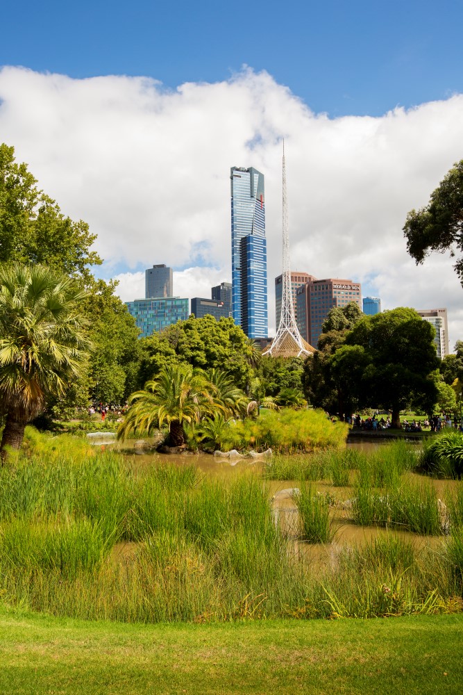
The second pond, known as the Nymph Pond, is 1100m2 in size and is deeper than the Children’s pond. This functions as both storage and treatment, with wetland plants providing aesthetic value and removing nutrients from the water. Similar to a raingarden, the biofilm that forms on the plant stems takes up pollutants, such as nitrogen and phosphorus, cleaning the water.

The top water level of the Nymph Pond is controlled by an overflow weir. The drawdown of water from this pond is generally set to 300mm from the top level, so that there is always enough water to support the plants and keep the ponds looking nice. However it can be varied as required and is controlled by the central control system.

To proceed to the next stop, walk along the length of the Nymph Pond, in the opposite direction to St Kilda Road. Ahead, you will come to the large Lower Pond with the waterfall flowing into it. Walk around the lower pond by following the path either to the left or the right, until you come to the short peninsula jutting out into the pond. This is Stop 2.

Stop 2: Lower Pond, Queen Victoria Gardens

You are standing at the third pond in the stormwater harvesting system, with Alexandra Avenue behind you.

D Hannah_X8A5253

This pond is known as the Lower Pond, the largest and deepest at a depth of 1 metre. The primary function of this pond is for storage, though water plants you can see around the edge and clustered throughout will provide some nutrient stripping as well. A pump transfers water from this pond to the biofiltration bed in Alexandra Gardens, maintaining a minimum water level of 300mm below top level. The diversion pumps shut off automatically when the ponds are full.

Plants are the main source of treatment for the stormwater in this system, taking pollutants from the water in the upper and lower ponds, as well as the biofiltration bed. Aquatic plants are used within the ponds, as well as some floating in the centre of the Lower Pond, with collective plant coverage of approximately 1600 m2.

Retrofitting the existing ponds to be part of the stormwater harvesting system involved draining and sealing them to prevent leaking.  The base of each pond was sealed differently due to their construction and known leakage:

  • The children’s pond had a concrete base and was painted with waterproofing membrane.
  • The Nymph Pond had a clay base liner which was rolled across the base. Rocks, clay and soil for planting were placed on top.
  • The lower ponds held water well throughout the drought and were deemed to be fairly water-tight. Only minimal contouring was carried out to provide more planting opportunities.


To proceed to Stop 3, walk along Alexandra Avenue to the pedestrian crossing and cross the road. Turn left after the crossing and walk back along the path until you reach the Skate Park and café. You are now at Stop 3.

Stop 3: Alexandra Avenue, Alexandra Gardens

At Stop 3, you are standing beside Alexandra Avenue, looking back across at the pond system in Queen Victoria Gardens.

At Stop 3, you are standing directly above the pipes that transfer the stormwater from the Lower Pond to the treatment system in Alexandra Gardens. Ideally, the treatment system and storage tank would have been located underground within Queen Victoria Gardens, but the unstable soil profile made this impossible.

Installing the pipes under this major road was one of the key challenges when constructing this system. In addition to the heavy volume of traffic, a number of service lines run underneath the road, including electrical, gas and communications cables.

Creating this link was a collaborative process between a range of stakeholders, both within the City of Melbourne and externally.  With a careful mapping of existing cables and a traffic management plan in place, a tunnel was bored under the road at night.

To move on to the next stop, walk away from Alexandra Avenue, past the café building and towards the skate park. You will see a garden bed containing grasses within a retaining wall. This is Stop 4.

Stop 4: Biofilter, Alexandra Gardens

At stop 4, you are standing beside a garden bed containing grasses.

This garden bed is a biofiltration system, also known as a biofilter. The biofilter cleans pollution from the stormwater so that it can be used for irrigation. The biofilter is constructed the same way as a typical raingarden, with a sand filtration layer, a transition and a drainage layer.

Alexandra Gardens, Nov2014 (7)

Water is pumped from the Lower Pond, under Alexandra Avenue and into this biofilter, periodically filling it with water. If you are visiting during a cleaning cycle, you might see stormwater flowing into the biofilter through the plastic fountains and slowly soaking down into the sand.

The flooding and resting cycle is based on the detention time of the water, which is determined by the hydraulic conductivity of the filter media. The cycle time is pre-set, but will be monitored and adjusted over time as the filter medium clogs and slows the detention time. Replacing the top of the filter media on an annual basis will renew the conductivity.

The clean water drains naturally under gravity to the 10,000 litre pump well before being pumped to the above ground storage tank where it can be used as required for irrigation.

The top layer of the biofiltration bed is planted with ephemeral wetland plants, Juncus gregiflorus and Juncus procerus. These native Australian rushes were planted as tube stock, rather than pre-grown plant slabs. Although pre-grown plants provide immediate water quality, planting them at a younger age is cheaper and can allow them to fully establish on site. Once per year, when the filter medium is replenished, the grasses are cut back to encourage vigour.

To move on to the final stop, continue along the path until you reach Boathouse Drive and the Yarra River. You have reached Stop 5.

Stop 5: Storage tank, Alexandra Gardens

You are at the edge of Alexandra Gardens, looking back in the direction of the Skate Park.

The large, oblong, concrete structure that you can see (adjacent to the public toilets) is the storage tank that hold the clean water from the stormwater harvesting system until it is need for irrigating the park. The tank holds about 230,000 litres. The UV disinfection, irrigation pumps and controls are housed alongside the tank.

Storage tanks for stormwater harvesting are commonly located underground to minimise the impact of the system on open space. In this instance, the soil profile was considered to be unsuitable because of the high proportion of unstable soil.

The site where the tank stands used to be a depot building, so no public open space was lost in the gardens as a result of the tank.


The tour is complete! Directly across the Yarra River is another stormwater harvesting system in Birrarung Marr. Take a tour of the Birrarung Marr stormwater harvesting system to learn more. 

Get social with the City of Melbourne
This website was delivered in partnership
with the State Government of Victoria
This website was delivered in partnership with the State Government of Victoria